

 Factfile – ice
Scientists use a number of different terms to describe polar ice.
Ice cap. This is an ice mass that covers less than 50,000km² of land area (usually covering a highland area). Masses of ice covering more than 50,000 km² are termed an ice sheet. Ice caps are not constrained by topographical features (i.e., they will lie over the top of mountains).
Glaciers are ‘rivers of ice’ which flow from the areas of snow accumulation which feed them to areas where ice is lost either by melting or iceberg calving.
Ice stream. This is a region of an ice sheet that moves significantly faster than the surrounding ice. Ice streams are a type of glacier.
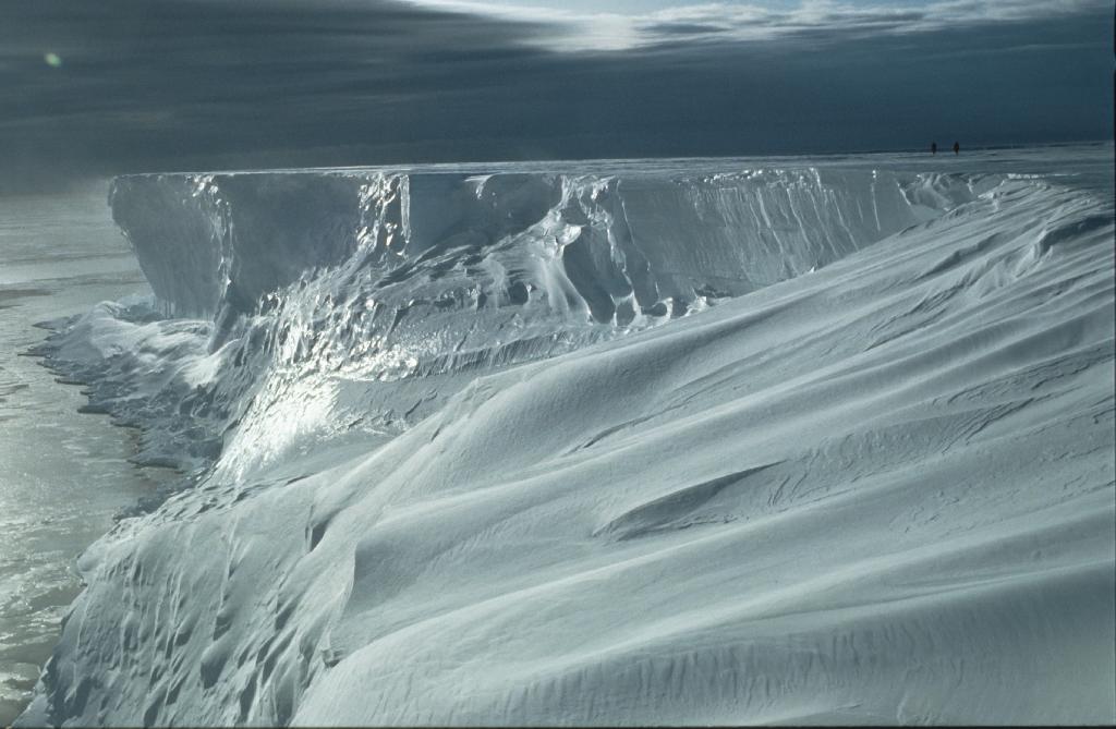
Ice sheets. The polar ice sheets are the huge layers of ice up to 4.9km thick covering Antarctica and Greenland. The Antarctic ice sheet is composed of snow falling in the interior of the Antarctic which compacts into ice. The ice sheet slowly moves across the bedrock towards the coast becoming floating ice shelves then eventually breaking away as icebergs which gradually melt into the sea.
Grounding line. This is the point of land at the coastline at which a glacier flows onto the sea, forming a floating ice shelf.
Ice shelf. This is the floating extension of the grounded ice sheet. Ice shelves are composed of freshwater ice that originally fell as snow, either in situ or inland and brought to the shelf by glaciers. Because they are already floating they have no direct impact on sea level when they break up. Ice shelves act as a natural barrier that slow the flow of ice from the Antarctic continent into the oceans. Sea level will rise if the ice held back by the ice shelf flows more quickly onto the sea.
Sea ice is frozen sea water that surrounds the Antarctic continent. It changes in area depending on the time of year. Around the Antarctic it is only 1-2m thick, but it provides effective insulation between the frigid Antarctic atmosphere and the relatively warm ocean below. By the end of winter the ice covers an area of 19 million square kilometres, more than doubling the size of the continent.
Nunataks (from Inuit nunataq) are often a ridge, mountain, or peak not covered with ice or snow within (or at the edge of) an ice field or glacier. The term is typically used in areas where a permanent ice sheet is present. Nunataks present readily identifiable landmark reference points in glaciers or ice caps and are often named.
