

Ocean under ice: Ocean circulation and melting beneath the ice shelves of the south-eastern Amundsen Sea (iSTAR B)
Principal Investigator: Dr Adrian Jenkins, British Antarctic Survey
Our science challenge
The speed of changes to the West Antarctic ice sheet, where Pine Island Glacier flows into the sea at Pine Island Bay, has taken scientists by surprise. This vast river of ice carries as much water as the River Rhine in frozen form. The last 60 km of the glacier floats on the waters of Pine Island Bay, and the bottom melts so intensely that half of the ice carried in the glacier is lost within the space of 30 years. Pine Island Bay is geographically the far south of the Pacific Ocean, and the image of warmth that this conjures up is not entirely misplaced. The air temperatures rarely rise above freezing, but beneath the cold surface of the sea, water temperatures rise as high as 1 degree Celsius – well above the freezing point.
Our research goal
Our research mission is to understand what “warm” and “rapid” really mean for Pine Island Glacier. We want to understand what might cause the ocean temperature to change and if it does, by even a small amount, how this will affect the melt-rate change.
To find the answers to those questions we must make measurements of the water temperature beneath the glacier, and simultaneous measurements of the rate at which the base of the glacier is melting into the ocean, but to do so is enormously challenging. The glacier is between 300 m and 1 km thick and difficult to access at its base. To achieve our goal we will use cutting-edge technology.
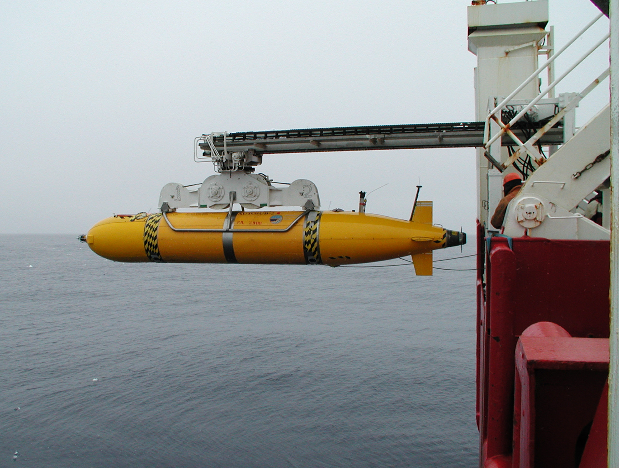
Our ocean and ice missions
To understand what’s happening in the ocean a robotic submarine (Autosub) capable of diving beneath the ice, will make measurements along a pre-defined track then return to the surface with the data. The robot submarine, designed and built by engineers at NERC’s National Oceanography Centre, has already proved itself on preliminary missions beneath Pine Island Glacier in 2009.
To understand the rate at which the thickness of the ice changes we have developed four autonomous radar instruments, engineered to allow year-round operation, to enable precise monitoring of the gradual change of ice thickness with time. These instruments will be left on the glacier’s surface throughout the Antarctic winter. These systems combine a well-known radar technique, FMCW radar, with careful measurement of the phase of the return echoes to establish the position of unique features in the image, such as the bottom of the glacier, with very high precision of the order of 1 mm over a 1 km range.
Armed with the data from these new instruments we will use a computer model that describes the flow of water within the remote cavern beneath the glacier and in the sea to the north of it. Using this model we will determine how heat that is transported into the cavern by ocean currents is used to melt the ice shelf and what impact changes in the climate of this part of Antarctic will have on the ocean currents and resulting melt rates.
Our research outcomes
The research will shed new light on the processes that are driving change in this part of the Antarctic ice sheet. All the datasets will be archived in the British Oceanographic Data Centre so they can be used by the wider scientific community.
